At Ride Sheffield we are always keen for local riders to come to us with good ideas, and this one from Nick Blaney is a belter. As a Ride Sheffield supporter Nick has something for you all to entertain yourselves during these soggy dark winter months. Over to Nick….

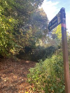
The Countryside Rights Of Way Act 2000 has set a deadline of January 2026 for rights of way claims to historic paths which existed before 1949 but not currently registered as Public Rights Of Way(PROW). What does this mean for mountain bikers, horse riders and walkers? Well any ‘white lanes’ or unregistered tracks we currently use as part of our routes could be blocked by landowners at any time.
The Ramblers Association and the British Horse Society have started projects, ‘Don’t Lose Your Way’ and ‘Project 2026’ respectively, to help identify historic paths and lanes and make submissions to have these legally registered as PROW’s through Definitive Map Modification Orders (DMMO’s) applications. These usually require painstaking evidence gathering and a good understanding of the process.
In addition the Sheffield Lakeland and Landscape Partnership(SLLP), which covers the area inclusive of Redmires, Rivelin, Derwent Edge, Langsett, Midhope and Underbank, Walkley and Worrall (mainly S6, northern part of S10 and southern bits of S35 and S36), have a Highways Heritage Project(HHP) which has made great progress in identifying over 50 possible routes. These include DMMO applications for historic tracks, ‘white lanes’ on your OS maps, options to upgrade suitable footpaths to bridleways and potential for new bridleways through private land. These require diligent research or building positive working relationships with landowners such as Sheffield City Council, Yorkshire Water and estate owners.
So what can we do as mountain bikers in Sheffield? If you live outside the SLLP boundary (quite thoroughly researched already) check your local OS maps to see if your local routes are official. If not, are they ‘white lanes’ or potentially historic drovers paths of cart tracks? Are any of your local footpaths good candidates for upgrade to bridleway status? Do you know any horse riders in your local area who may already be looking in to this? If so make contact.
I am now trained to record potential historic rights of ways through the BHS Project 2026 website so let me know of any candidates in your area. I can also provide some advice on how you may make a start engaging with the right parties for other potential (non historic) rights of ways changes.
If you are a bit of a map geek like myself the National Library for Scotland has digitised copies of all OS maps from 1850 onwards. Unfortunately SCC does not have digitised copies of the local Definitive Map or any local parish maps that predate 1850.
Some useful background information in the links below:
Sheffield Lakeland Land Partnership (including map)
British Horse Society Project 2026
To get involved please email Nick Blaney at nicbla62@gmail.com to show your support and help protect our trails.